Dhading Information
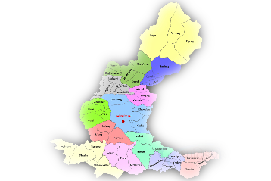
Dhading district, a part of Bagmati zone, is one of the seventy-five districts of Nepal, a landlocked country of Southeast Asia. The district, with Dhading besi as its district headquarters, covers an area of 1,926 sq km and has a population (2001) of 338,658. The mountain range ‘Ganesh’ is the predominate mountain range located within Dhading. All of the peaks are over 7,000 meters with some approaching 8,000. The 8,000+ meter moutain ‘Manaslu’ is clearly visible from much of Dhading, although it is located within the bounds of Gorkha. The transnational ‘King Prithivi Highway’ connecting Kathmandu and Pokhara runs through the southarn portion of the district making for easy access too the Kathmandu valley. The road parallels the ‘Trishuli’ River.
The famous temple ‘Manakamana’ is located within Dhading. Dhading is 80% farmland and 20% forest; unfortunatly most of the protected forest is located near or next too the road which dosen’t make for great trekking. But, the western border with Gorkha is bisected by the ‘Buri Gandaki’ river and this river valley is a great entrance to the Himals of Gorkha (with views of the GaneshHimal range), not to mention one of the prettier rivers of Nepal. The towns of Phulkharka,Salantar and Arun Ghat should get you pointing in the right direction. The people of the district are primarily Bhramin and Chetri in the south and Tamang and Gurung in the north, with much of the center Newari.